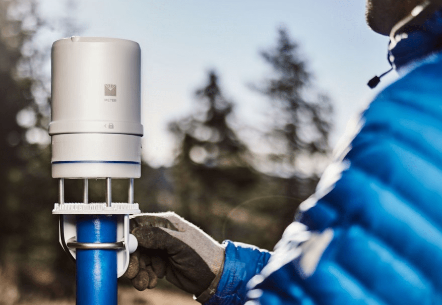
Skip to content

Posts by Colin Campbell

What plant hydraulics tell us about drought response

Trees are merchants; they sell water to the atmosphere in exchange for the CO2 they need to photosynthesize sugars. The exchange rate or ‘water-use efficiency’ that drives the plant carbon-water market place is a function of atmospheric CO2 concentrations. Thus, theoretically human carbon emissions, which have increased atmospheric CO2 by 40% since 1850, should increase plant water use efficiency, resulting in “CO2 fertilization” of our forests and crops. 

La Plata mountains

La Plata Mountains, where the study gradient is located

However, evidence for CO2 fertilization is extremely mixed. That’s why Leander Anderegg, postdoctoral fellow at UC Berkeley, and his research team are performing a two-step experiment to determine if increased atmospheric CO2 conditions increase plant water-use efficiency. The team is leveraging a natural elevation gradient in temperature, vapor pressure deficit, and precipitation on a southwestern Colorado mountain to understand:

  1. How much physiological variation is on a single mountain slope between two species
  2. How that variation ultimately affects the potential for CO2 fertilization and differential vegetation responses to rising CO2

For five years, the team has worked on quantifying how two tree species (Ponderosa Pine and Trembling Aspen) can shift their physiology going from low elevation (hot, high vapor pressure deficit environments) up to high elevation (wet, cooler, low vapor pressure deficit environments). They want to understand what that means for each species’ water relations, drought vulnerability, and biogeography in a drying and warming climate.

Quantifying weather parameters  

Anderegg and his team use METER all-in-one weather stations to quantify exactly how much the local environment changes from the bottom to the top of the mountain. Anderegg says he’s been surprised at how influential vapor pressure deficit changes are on the tree species. He says, “When we compare Aspens to Ponderosas, we’ve found that the difference in atmospheric demand is a big part of the story, particularly in how they respond to drought stress. There is more atmospheric demand at the bottom of the mountain. So one key objective was to quantify how much drier the air was during the peak mid-summer dry down for most of the species. This was critical then to infer how stomata were responding to that gradient and water stress. It’s really difficult in these wide field plots to actually measure transpiration. But with physiological measurements of leaf water potential, hydraulic conductivity, and the vapor pressure deficit from relative humidity sensors, we could then infer how open the stomata were.”

Image of a researcher coring a Ponderosa to measure its growth rate

Coring a ponderosa to measure its growth rate

Anderegg used a pressure chamber to measure leaf water potential and also did a lot of shotgun sampling to measure the hydraulic conductivity in twigs. He describes the process, “I went out at 3 am with a 20 gauge shotgun loaded with birdshot to shoot off branches. We pulled water through the branches by applying a vacuum to a pressure chamber and then inserting one end of the branch. To get the hydraulic conductivity of the branch, we measured how quickly the water moved into the chamber.” (Kolb et al 1996)

Vapor pressure deficit was surprising

Anderegg says vapor pressure deficit changes across the elevation gradient were much stronger than he expected. He says, “It was pretty impressive that as you drove up this elevation gradient, the vapor pressure deficit differed by approximately 1.5 kPa. In the crop realm, a vapor pressure deficit of 2 kPa is pretty intense, but we went from a bit over 1 kPa near the top of the mountain to more like 3 kPa down at the drier bottom, which translates to a remarkably different water-use efficiency. 

Two species—two adaptation strategies

When asked what they’ve learned, Anderegg says the difference between the two tree species is pretty amazing. “We’ve seen that the two species have extremely different responses to drought stress. Aspen keeps its stomata open, even at the bottom of the mountain where it’s really dry. It just alters its hydraulic system to try and keep up with it. The Ponderosa, however, does not alter its hydraulic system. It just closes its stomata until it rains in the fall.”

A dead Aspen tree next to a living Ponderosa tree

An aspen that died following a drought while it’s neighboring ponderosa lived

Anderegg adds that the two different water relations strategies line up with the type of biogeographical shifts occurring in the two species as the Southwest dries out. He says, “Aspen is sort of a ‘grin-and-bear-it’ species that toughs out drought while Ponderosa is a ‘sit it out’ sort of species. For the last 15 years, the Aspen have been creeping uphill but not gradually. Intermittent droughts are slowly trimming the driest Aspen up the hill in fits and starts. Ponderosa are better at dealing with extreme droughts because they preserve their hydraulic systems. We have not seen mortality pushing the Ponderosa uphill. However, there’s essentially no Ponderosa recruitment (new tree starts) at the bottom of the hill, and the growth rates of adults are a quarter of the rates at the top of the hill. So we think the Ponderosa will move uphill following mean climate change and not in fits and starts. They’ll gradually die off at the bottom and not be replaced by young recruits which will cause them to move uphill in a more gradual manner.”

Dying Aspen tree in the middle of a low elevation Aspen stand

Dying aspens in the middle of a low elevation aspen stand

Transitioning toward the future

In the years ahead, Anderegg hopes to move into the second phase of the experiment: testing how these two species will respond to CO2 fertilization. He says, “We need to make these measurements over multiple years and many environmental conditions to start to get at how much plasticity any individual plant can manifest (plasticity is the amount that a plant can change its physiology in response to climate change. So if this condition happened, how likely is the plant to respond in a particular way over time) and what the long term trajectories are in these hydraulic traits. We’ve gotten measurements at the height of a significant drought and then another medium year following that drought. We want to transition toward a long-term monitoring perspective that hopefully will give us the information we need to start thinking about how CO2 then plays in.” 

You can learn more about Leander Anderegg’s research here: ldlanderegg.com

Reference

Kolb KJ, Sperry JS, Lamont BB (1996) A method for measuring xylem hydraulic conductance and embolism in entire root and shoot systems. Journal of Experimental Botany. 47:304, pg 1805-1810

See ATMOS 41 weather station performance data

Download “The researcher’s complete guide to soil moisture”

Download “The researcher’s complete guide to water potential

Download “The researcher’s complete guide to Leaf Area Index

Chalk Talk: Why is Humidity Relative?

Dr. Colin Campbell, a senior research scientist at METER Group, as well as adjunct faculty at Washington State University teaches about relative humidity.

Image of a forest with clouds and fog everywhere
Comparing RH at different research sites can be a challenge

Watch the video to find out why we use the term relative humidity and why comparing RH at different research sites can be a challenge.


Video transcript

Why is humidity relative?

Hi, I’m Dr. Colin Campbell. I’m a senior research scientist here at METER Group, as well as adjunct faculty up at Washington State University. And I teach a class in environmental biophysics. And today, we’re going to be talking about relative humidity. Have you ever looked at a weather report and wondered, what do they mean by the term relative? Why aren’t we talking about absolute things? And so today I’m going to talk about what is relative humidity? Well, relative humidity we’re going to define here as just hr. And hr is equal to the partial pressure of water vapor in air divided by the saturation vapor pressure or the maximum possible partial pressure of water in air as a function of temperature. So this is relative because anytime we have a partial pressure of water vapor, we’re always dividing it by the maximum possible water vapor that could be in the air at any point.

Comparing RH at different sites is a challenge

So, why would relative humidity be such a challenge for us as scientists to use in comparing different sites? I wanted to talk about that so we can focus in here on this saturation vapor pressure. Over here we have Tetens equation. This says that the saturation vapor pressure, which is a function of air temperature is equal to 0.611 kPa times the exponential of a constant “b” times the air temperature divided by another constant “c” plus the air temperature. So at any point, depending on the air temperature, we can calculate the saturation vapor pressure, and then we can put it back into this equation and get our relative humidity. There are two situations we might think about for calculating our saturation vapor pressure. The most typical is this one: where that constant “b” is 17.502 degrees C. And the constant “c” is 240.97 degrees C (the units on this are degrees C, so these will cancel). If we’re over ice, those constants will be different: “b” would be 21.87 degrees C and “c” would be 265.5 degrees C. 

So as I mentioned, relative humidity is a challenging variable to use in research because while vapor pressure (ea) (the vapor pressure of the air) is somewhat conservative across a day, the saturation vapor pressure (with respect to air temperature), this changes slowly with temperature across the day. So if we graphed temperature on one axis and the relative humidity on the other axis, we might during a typical day have a temperature range that looks somewhat like this. And even if the actual vapor pressure “ea” wasn’t changing, we’d see a relative humidity trend that looked like this: only changing because of air temperature. And because of that, if we wondered how do I compare the water in the air at one research site, for example, with the water in the air at another research site? We might be inclined to average them. But because of this trend, the average of the relative humidity at any site tends to be around 0.60 to 0.65 and therefore will be totally irrelevant in the literature. 

So we need to speak in absolutes, and in my next lecture, I’m going to go into what we can do to calculate that absolute relative humidity. If you want to know more about making measurements in the atmosphere, go to metergroup.com, look at our atmospheric instrumentation, and you can learn more from there.

Download “The researcher’s complete guide to soil moisture”

Download “The researcher’s complete guide to water potential

The effects of environmental change on carbon cycling across the semi-arid west

Meet Christopher Beltz: G.A. Harris Fellowship winner

Increased nitrogen availability has the potential to alter many ecosystem functions—and is doing so already. This is due to the widespread response of net primary productivity (biomass) and soil respiration to increased nitrogen inputs into the biosphere.

Image of the grass lands with the sun setting

Grass Lands

Increases in nitrogen inputs are responsible for the acidification of soils, streams, and lakes and can affect forest and grassland productivity. Former G.A. Harris Fellowship winner, Christopher Beltz, a PhD student at Yale University, and his research team are examining two major drivers of carbon cycling: water and nitrogen. They want to understand the degree of limitation by both of these factors in the semi-arid ecosystems of the western United States and if that limitation changes by specific function.

Inspired by a mitigation pilot project

Beltz decided to study the effects of increased nitrogen on biomass after learning about the initiation of a major energy development in a sagebrush steppe system which caused declines in a local mule deer herd. He says, “One hypothesis was that the development significantly reduced available winter range forage and also impacted the use of it as the animals moved more quickly through the noisy environment. They wanted to see if the widespread application of fertilizers would potentially offset the loss of biomass and increase the forage quality. In the end, it was clear that the effect of nitrogen fertilization alone would have minimal to no effect. However we also noticed some variability in the results and that this variability seemed to be related to precipitation.”

Image of a scientist watering a field plot

Scientist Watering Field Plot

Beltz thought that if he could control the water in a system in addition to nitrogen, the results might be more consistent. Thus, Beltz and his research team broadcast nitrogen over the soil at three semi-arid grassland and shrubland/sagebrush sites in Colorado and Wyoming. He says, “The three sites essentially have a similar species list, annual precipitation, and annual temperature. However, temperature increases as you go south, and there are some differences in seasonality. The shrublands in the far north are the driest in the late summer which is typical of shrublands, where you see a large amount of precipitation occurring in the spring with a deficit in the summer. Larger taproots are beneficial in this system because they can access deeper water reservoirs.”

Measuring soil moisture improves understanding

The team used METER all-in-one weather stations, soil moisture sensors, and data loggers to monitor site conditions (i.e., precipitation, air temperature, soil moisture, and soil temperature) with high temporal resolution. Beltz explains, “We monitored soil moisture to understand whether our treatments were having any effect. We needed to know if the treatments actually altered the soil water conditions. With soil sensors in the ground, we could monitor that. We also monitored precipitation at the site level because of the fine scale spatial heterogeneity of precipitation in these systems. We weren’t confident we could obtain this with interpolation or modeling; we wanted site-specific values.”

Beltz uses this and other data to understand the interactive effects of nitrogen and water and also changes in water and nitrogen concentrations. He says, “We do a classic full-factorial manipulation outdoors. We perform the exact same manipulations with the same timing at each site. We measure a whole suite of variables that range from ecosystem structure to ecosystem function. This includes soil respiration, plant community, soil microbial communities (fungal and bacterial) using next-generation sequencing. We look at pools of soil carbon, and we do some fractionation so we can get at more labile and recalcitrant carbon compounds.”

METER weather station, ZL6 data logger, and soil moisture sensors

METER Weather Station, ZL6 Data Logger, and Soil Moisture Sensors to Receive and Process Data

Beltz says that monitoring soil moisture at multiple depths is important. “Our soil samples come from the same depths as the sensors so we can differentiate depth when we look at changes in bacterial or fungal composition. We then try to tie that to temperature and moisture. In 2018, we added an additional set of soil moisture sensors in our water treatment so we could start to quantify the effect in the soil depth that those water treatments were having. This helped explain a lot of what we were seeing.”

Nitrogen or water: which is the driver?

Beltz says the analyses are ongoing, but what they’ve learned so far is that an application of water equivalent to 12 millimeters precipitation penetrates to 10 centimeters of depth, and the effect of that application lasts three to seven days at all of their sites. He says, “Last year, we had an unseasonably large amount of precipitation at our northerly site. So for most of the season, the water treatments and the controls were identical in terms of water availability. That was a very helpful context for us because we started to see things that did not match the expected patterns.”

Looking at the big picture, he adds, “What’s come out of this is not what anybody expected. One major finding, at least in the initial analyses at two of our sites, is that it’s really the combined treatment of increased nitrogen and water that has the effect. This is not necessarily surprising in some ways, however it is the widespread lack of response of any other treatment combination that is extremely interesting.”

What it all means

Beltz sums up the implications of his research like this: “We know water availability and precipitation will shift globally due to climate change, as well as nitrogen deposition and availability. Our research is trying to tease apart the effects of two factors, at least within the western United States, that we know are likely to cause changes to the structure and function of dryland ecosystems. As we start to look at carbon balance or shifts in function or species competition of plant communities, we are finding out that it’s the combined effect of increased nitrogen and water that will cause a more major change as opposed to just one or the other. It’s important that we integrate that combination into models that often do not account for both of these factors.”

Beltz says in the future he’s interested in continuing his work in the carbon/nitrogen cycle world, and he wants to look at integrating nitrogen and water into carbon balance modeling efforts.

You can read more about the first study mentioned, regarding nitrogen fertilization in the sagebrush steppe, which was published in PloS ONE: https://doi.org/10.1371/journal.pone.0206563

Find out about his research here: christopherbeltz.com or via Twitter @BeltzEcology

Now accepting applications: 2019 G. A. Harris Fellowship

The Grant A. Harris Fellowship provides $60,000 worth of METER research instrumentation (six $10,000 awards) to graduate students studying any aspect of agricultural, environmental, or geotechnical science.

Apply now

Learn more

See ATMOS 41 weather station performance data

Learn more about measuring soil moisture. Download “The researcher’s complete guide to soil moisture“.

To understand how soil moisture and soil water potential work together, download “The researcher’s complete guide to water potential.”

Data deep dive: why am I seeing diurnal changes in soil moisture?

In the video below, METER soil scientist Dr. Colin Campbell discusses an often-misdiagnosed water content signal that looks like typical diurnal temperature cycling but is actually due to a phenomenon called hydraulic redistribution. He shows how easily these patterns can be seen in ZENTRA Cloud data management software.

Watch the video


Learn more

Learn more about measuring soil moisture. Download “The researcher’s complete guide to soil moisture“.

To understand how soil moisture and soil water potential work together, download “The researcher’s complete guide to water potential.”

Video transcript

Hello, my name is Colin Campbell. I’m a research scientist here at METER Group. And today we’re going to be digging into some water content data that I collected over the last summer. This is a field that’s planted in spring wheat, it’s about 700 meters across. And we’ve set up six measurement sites. At each one of these sites, we’re making several measurements, but the ones we’re going to talk about today are just water content. And while we’ve installed water content sensors at 15, 45, and 65 centimeters, we’re just going to focus on the 65-centimeter water content sensors. These sensors are the METER TEROS 12 soil moisture sensors, so they also measure electrical conductivity and temperature, and we’re going to look at temperature as well because that figures into this discussion. 

So this field was planted in April of 2019. And not a lot interesting goes on at the 65-centimeter depth through April, May, and June. But as we get into July, the wheat is reaching maturity, and they essentially are going to cut off the irrigation water here on July 22. So up to July 22, there’s really not a lot of movement in the water content. One of the sites decreases a little bit, but each line is flat. What I noticed as I was looking at this particular graph is after this long period of very flat data, after June 22 when the irrigation was cut off, we start to see some movement in the water content at this depth Not only is there movement down, but there’s a daily movement of the actual water content signals, all but this top light green line. And it made me wonder, what’s going on? 

Image of a field of wheat

Diurnal water content fluctuations are not always due to temperature.

Initially, whenever you see a diurnal movement, you suspect that it’s caused by temperature. It’s been said that every sensor is probably a temperature sensor first, and a sensor of whatever we’re really interested in second. In this case, we can look to see what the temperature is doing at that depth. Here’s soil temperature, at 65 centimeters, and even though there’s just a little bobble in the line, the line is almost completely flat. We see the seasonal trends in temperature, but really no diurnal temperature cycling. And this scale is also fairly small. So back to our 65-centimeter water content. If it’s not temperature that’s affecting these lines, then what is it? 

I’ve seen this before in an experiment that I did years ago in a non-irrigated wheat field. We were measuring down at  150 centimeters, and when the water had been used up in the upper levels of the soil profile, the roots of the wheat plant just simply went down to 150 centimeters and started taking water up. So this is what I assume is also happening here. The wheat has extended its roots down to 65 centimeters, since its irrigated wheat. That’s not too deep, but wheat doesn’t necessarily need to get its roots down super deep. And as the wheat accesses that water, we’re seeing these daily drops in water. But then we’re seeing just a slight increase in water. Here on July 28, we’re seeing that water go up slightly. And so why is this happening? We might understand how the water is being taken out of the soil, but why do we see a slight increase in the water content (just a few tenths of a percent)? 

What I think is happening, in this case, is that it’s not temperature, but actually, roots are growing down into this area, and they’re probably growing around the sensor. As we change from day to night, we see a release in the elasticity of the water in the xylem, and maybe just a little bit more water down in the roots as they’re the transpiration pull of the day is lessened and stops overnight. The stomates are closed, and we see just a little bit of water coming back into the roots and possibly into the soil. 

Now there was a big discussion many years ago about whether this was something called hydraulic lift where trees could take up water from deep in the soil profile and essentially give it back to plants near the surface. And although it was a great debate, it was never proven that this actually happened: water being spread from deeper locations to more shallow locations by roots. But this is probably hydraulic redistribution where we just have roots filling with water, and when they are filled, we see a little bit in the water content sensor.

Soil moisture sensors aid forensic science in time-of-death estimates

Extending time of death estimates

Forensic scientists are looking at better, more accurate ways of determining the post-mortem interval, or time of death. When a human body decomposes, microbes and nematodes become abundant in the soil surrounding the body. The types and maturity of these organisms may be a means of determining the time of death, but thus far most studies have focused on short post-mortem time frames.

Image of a footprint in the dirt
Scientists look for ways to increase the accuracy of long-term post-mortem interval estimates

That’s why Stacy Taylor, her advisor, Dr. Jennifer DeBruyn, and their research team at the University of Tennessee are using cutting-edge molecular techniques and classical microscopic techniques to try and extend the time frames over which this approach could be used to determine how long it’s been since victims have died. 

Monitoring dramatic soil changes   

Taylor, a winner of the National Institute of Justice Graduate Research Fellowship in STEM, working in conjunction with the UT Anthropology Research Facility, is measuring biological and chemical changes in soil composition brought about by long-term human decomposition. She says, “We are looking at a combination of soil chemistry, microbial ecology, and some of the soil animals, particularly the nematodes, to get an entire food web approach in understanding all of the nutrient cycling that is occurring in these systems. We want to look at the soil chemistry patterns and microbial/nematode succession to see if these cross-inform each other.” 

Taylor explains some of the changes in soil composition that occur during both vertebrate and invertebrate decomposition, “Basically, any time you have a decomposition event that is not composed of plant litter, it creates what’s called a “hot spot” of nutrient enrichment. Unlike plant litter, which decomposes very slowly, with a vertebrate system you have a tremendous amount of protein and fat. You also have a lot of calcium, magnesium, sodium, and potassium. And when you put a large load of these things into the soil, you get a huge change in soil organic composition, nutrient availability, and soil moisture. So you’re essentially dealing with massive changes in a very localized soil environment.”

Decomposition also changes the soil water

Taylor and her adviser Dr. Debruyn had the fairly new idea to insert METER soil moisture, temperature and electrical conductivity sensors connected to data loggers into the soil in these hot spots, to see what kind of interesting data would turn up.

Updated version of the TEROS 12 sensor
The TEROS 12 is an updated version of the sensor Taylor used in her research

She says they’ve been surprised at how informative and eye-opening this has been. She explains, “These hot spots change the ionic strength of the soil water. And that is highly correlated to electrical conductivity, which is measured by the soil moisture sensors. A change in ionic strength potentially impacts the salinity of the soil. Some of those changes have been shown to persist for well over a year, which is what these soil sensors are showing. I take an hourly reading, and the sensors are producing the most amazing data.”  

Taylor says the sensors were inserted into the soil surface, so they could measure the impact the decomposition produced immediately on the upper layer of soil. They took soil cores at 16 centimeters to measure soil pH and EC, and they also used RT-1 air temperature sensors to track accumulated degree days which are based on ambient air temperature and correlate with maggot growth and development rates. 

Identifying time markers

Taylor says that soil changes (in particular EC and temperature) are not just general deviations but show clear stages as decomposition progresses through time, indicating they might be useful as time markers. She explains, “We are tracking a succession of events. These events happen at particular time points and are associated with certain decomposition stages (i.e, bloat, active decay, advanced decay, or skeletonized remains). For example, you might see traces of increased electrical conductivity followed by a drop. If that drop happens at the same stage of decomposition, over and over, then you know that you have a time marker. And when you gradually accumulate some of these time markers, that can potentially inform some of the existing estimates of how long something has been there.”

Crime scene tape in front of an accident
Taylor’s study is about bringing better justice and more peace to the families of crime victims.

What’s the future?

Taylor says the implications of this study will help nail down many of the intrinsic controls on the decomposition process. And once they understand that, they’ll have a better idea how to employ these estimates of post mortem interval, which will bring better justice and more peace to the families of crime victims. About the future of the research, she says, “This is the kind of study that you want to replicate at other human decomposition facilities that vary by altitudes, weather, soils, and more. You need to be able to look at a variety of environments just to see what happens.”

You can read more about Stacy’s project here.

To learn more about measuring soil moisture, download “The researcher’s complete guide to soil moisture“.

To understand how soil moisture and soil water potential work together, download “The researcher’s complete guide to water potential.”

Chalk Talk: Intensive vs. Extensive Variables

Learn the difference between intensive and extensive variables and how they relate to soil water potential vs. soil water content in our new Chalk Talk whiteboard series. In this video series, Dr. Colin S. Campbell teaches basic principles of environmental biophysics and how they relate to measuring different parameters of the soil-plant-atmosphere continuum.

Watch the video


Learn more

To learn more about measuring water potential vs. water content read: Why soil moisture sensors can’t tell you everything.

Download the “Researcher’s complete guide to water potential”—>

Download the “Researcher’s complete guide to soil moisture”—>

Video transcript

Hello, my name is Colin Campbell. I’m a senior research scientist here at METER group. And I teach a class on environmental biophysics. Today I wanted to talk about something we teach in the class: the difference between extensive and intensive variables. I’d like to do this with the goal of relating it to the difference between volumetric water content and water potential. 

Here, I have a picture of a ship moving through the ice and some metal that’s been heated in a furnace. I think we would agree the ship has the highest amount of heat in it compared to this very small piece of metal. And if we placed that piece of metal onto the outside of the ship, despite the fact that there is more heat in the ship, we know the heat would not move from the high amount of heat (ship) to the low amount of heat (metal). It would actually move from the highest temperature to the lowest temperature. Why is that?

The reason is that heat moves because of temperature and not because of heat content or the amount of heat in something. Heat content defines an amount or an extent. And we generally term something that defines an extent or an amount as an extensive variable.An extensive variable depends broadly on the size of something or how much of something there is. 

This differs for temperature. Temperature doesn’t depend on size. The temperature could be the same in a very small room or a very large room, but the amount of heat or heat content in those rooms would be quite different. When we describe temperature, we talk about intensity, which is why we call these types of variables intensive variables. This is because they don’t depend on size or amount. 

Let’s talk about another example. Here’s your heating bill. Maybe it’s natural gas. What you’re paying for is the amount of heat you put into the house. But the question is, are you comfortable in the house? And from this bill, we can’t tell. Maybe you put in 200 heat units, whatever those might be. We can’t tell if that’s comfortable because we don’t know the size of the house or the type of insulation. All those things would influence whether you were comfortable. 

Alternatively, if the temperature is 71 F that’s quite comfortable. That’s equivalent to about 22 degrees Celsius. So the intensive variable, temperature, is different than the extensive variable, heat content, that tells us how much heat we put in. And that’s important because at the end of the day, that leads to cost. 

On this side, we don’t know how much we paid to keep it at 22 C because heat content doesn’t tell us anything about that. But the intensive variable temperature does tell us something about comfort. So both of these variables are critical to really understanding something about our comfort in the house. 

Now let’s talk about the natural environment. Specifically, we’re going to talk about soils. We’ll start with the extensive variable. When we talk about water in soil, the extensive variable is, of course, water content. Water content defines the amount of water. Why would we care about water content? Well, for irrigation or a water balance.

The intensive variable is called water potential. What does water potential tell us? It tells us if soil water is available and also predicts water movement. If this soil had a water content of 25% VWC and another soil was at 20% VWC, would the water move from the higher water content to the lower water content? Well, that would be like our example of the ship and the heated piece of metal. We don’t know if it would move. It may move. And if the soil on either side was exactly the same, we might presume that it would move from the higher water content to the lower water content, but we actually don’t know. Because the water content is an extensive variable, it only tells us how much there is. It won’t tell us if it will move. 

Now, if we knew that this soil water potential was -20 kPa and this soil water potential over here was -15 kPa, we would know something about where the water would move, and it would do something different than we might think. It would move from the higher water potential to the lower water potential against the gradient in water content, which is pretty interesting but nonetheless true. Water always moves from the highest water potential to the lowest water potential.

This helps us understand these variables in terms of plant comfort. We talked about the temperature being related to human comfort. We know at what temperatures we are most comfortable. With plants, we know exactly the same thing, and we always turn to the intensive variable, water potential, to define plant comfort.

For example, if we have an absolute scale like water potential for a particular plant, let’s say -15 kPa is the upper level for plant comfort, and -100 kPa is the lower level of comfort, we could keep our water potential in this range. And the plant would be happy all the time. Just like if we kept our temperature between 21 and 23 Celsius, that would be comfortable for humans. But of course, we humans are different. Some people think that temperature is warm, and some think it’s cold. And it’s the same for plants. So this isn’t a hard and fast rule. But we can’t say the same thing with water content. There’s no scale where we can say at 15% water content up to 25% water content you’ll have a happy plant That’s not true.If we know something about the soil, we can infer it. But soil is unique. And we’d have to derive this relationship between the water content and the water potential to know that. 

So why would we ever think about using water content when we measure water in the soil? One reason is it’s the most familiar to people. And it’s the simplest to understand. It’s easy to understand an amount. But more importantly, when we talk about things like how much we’re going to irrigate, we might need to put on 10 millimeters of water to make the plants happy. And we’d need to measure that. Also if we want to know the fate of the water in the system, how much precipitation and irrigation we put on versus how much is moving down through the soil into the groundwater, that also relates to an amount.  

But when we want to understand more about plant happiness or how water moves, it’s going to be this intensive variable, water potential that makes the biggest difference. And so with that, I’ll close. I’d love for you to go check out our website www.metergroup.com to learn a little bit more about these measurements in our knowledge base. And you’re also welcome to email me about this at colin.campbell@meter group.com.

Take our Soil Moisture Master Class

Six short videos teach you everything you need to know about soil water content and soil water potential—and why you should measure them together.  Plus, master the basics of soil hydraulic conductivity.

Watch it now—>

Soil moisture: ECH20 vs. TEROS, which is better?

See how the new TEROS soil moisture sensor line compares with METER’s trusted ECH20 sensor line.

Image of TEROS 12 moisture sensor in front of wheat
TEROS 12 soil moisture sensor

Volumetric water content—defined

To evaluate the performance of any water content sensor, you need to first understand its technology. In order to do this, it’s necessary to understand how volumetric water content (VWC) is measured. Volumetric water content is the volume of water divided by the volume of soil (Equation 1) which gives the percentage of water in a soil sample.

Equation to measure volumetric water content

So, for instance, if a volume of soil (Figure 1) was made up the following constituents: 50% soil minerals, 35% water, and 15% air, that soil would have a 35% volumetric water content.

Diagram depicting soil constituents

The percentage of water by mass (wm) can be measured directly using the gravimetric method, which involves subtracting the oven-dry soil mass (md) from the mass of moist soil (giving the mass of water, mw) and dividing by md (Equation 2).

Gravimetric method to measure the percentage of water by mass

The resulting gravimetric water content can be converted to volumetric by multiplying by the dry bulk density of the soil (b) (Equation 3).

Gravimetric water content converted to volumetric by multiplying by the dry bulk density of the soil

Why capacitance technology works

Volumetric water content can also be measured indirectly: meaning a parameter related to VWC is measured, and a calibration is used to convert that amount to VWC. All METER soil moisture sensors use an indirect method called capacitance technology. In simple terms, capacitance technology uses two metal electrodes (probes or needles) to measure the charge-storing capacity (or apparent dielectric permittivity) of whatever is between them.

Diagram depicting how capacitance sensors use two probes to form an electromagnetic field

Table 1 illustrates that every common soil constituent has a different charge-storing capacity. In a soil, the volume of most of these constituents will stay constant over time, but the volume of air and water will fluctuate.

Charge storing capacity of common soil constituents

Since air stores almost no charge and water stores a large charge, it is possible to measure the change in the charge-storing ability of a soil and relate it to the amount of water (or VWC) in that soil. (For a more detailed explanation of capacitance technology watch our Soil Moisture: methods/applications webinar.

Capacitance today is highly accurate

When capacitance technology was first used to measure soil moisture in the 1970s, scientists soon realized that how quickly the electromagnetic field was charged and discharged was critical to success. Low frequencies led to large soil salinity effects on the readings. Over time, this new understanding, combined with advances in the speed of electronics, enabled the original capacitance approach to be adjusted for success. Modern capacitance sensors, such as METER sensors, use high frequencies (70 MHz) to minimize effects of soil salinity on readings.

The circuitry in capacitance sensors can be designed to resolve extremely small changes in volumetric water content, so much so, that NASA used METER’s capacitance technology to measure water content on Mars. Capacitance soil moisture sensors are easy to install and tend to have low power requirements. They may last for years in the field powered by a small battery pack in a data logger.   

TEROS and ECH20: same trusted technology

Both TEROS and ECH20 soil moisture sensors use the same trusted, high-frequency (70 MHz) capacitance technology that is published in thousands of peer-reviewed papers. Figure 3 shows the calibration data for the ECH20 5TE and TEROS 12.

Read the full article….

Download the “Researcher’s complete guide to water potential”—>

Download the “Researcher’s complete guide to soil moisture”—>

Soil Moisture 301—Hydraulic Conductivity Why you need it. How to measure it.

New Live Webinar

Hydraulic conductivity, or the ability of a soil to transmit water, is critical to understanding the complete water balance.

Researcher running hand over wheat
Soil hydraulic conductivity impacts almost every soil application.

In fact, if you’re trying to model the fate of water in your system and simply estimating parameters like conductivity, you could get orders of magnitude errors in your projections. It would be like searching in the dark for a moving target. If you want to understand how water will move across and within your soil system, you need to understand hydraulic conductivity because it governs water flow.

Get the complete soil picture

Hydraulic conductivity impacts almost every soil application: crop production, irrigation, drainage, hydrology in both urban and native lands, landfill performance, stormwater system design, aquifer recharge, runoff during flooding, soil erosion, climate models, and even soil health. In this 20-minute webinar, METER research scientist, Leo Rivera discusses how to better understand water movement through soil. Discover:

  • Saturated and unsaturated hydraulic conductivity—What are they?
  • Why you need to measure hydraulic conductivity
  • Measurement methods for the lab and the field
  • What hydraulic conductivity can tell you about the fate of water in your system

Date: August 20, 2019 at 9:00 am – 10:00 am Pacific Time

See the live webinar

REGISTER

Can’t wait for the webinar? See a comparison of common measurement methods, and decide which soil hydraulic conductivity method is right for your application. Read the article.

Download the “Researcher’s complete guide to water potential”—>

Download the “Researcher’s complete guide to soil moisture”—>

Freshwater shrimp grown in Korean rice paddy boost grower income

In South Korea, falling rice prices threaten the livelihood of many rice growers. Recently our Korean reps told us about an experiment performed in Jinju city, Gyeongsangnam-do, South Korea, by GNARES (Gyeongsangnam-do Agricultural Research & Extension Services) to increase grower income through simultaneous freshwater shrimp, lotus plant, and rice cultivation in a paddy field.

Image of a researcher working on freshwater shrimp growth

RT-1 water temperature sensors were installed along with METER data loggers to monitor the water temperature, ensuring it was optimal for shrimp growth. Through this experiment, GNARES found that environmental conditions were good for cultivating freshwater shrimp in this area. 

Graphs show the plantations are good for cultivating freshwater shrimp

Download the “Researcher’s complete guide to water potential”—>

Download the “Researcher’s complete guide to soil moisture”—>

Engineers Without Borders alleviates Panamanian village water security issues

Engineers Without Borders (EWB) at Washington State University in Pullman, WA has partnered with a small indigenous village located in the Comarca Ngäbe-Buglé region of Panama. The relationship between this village and EWB at WSU began in 2016 when WSU alumna Destry Seiler began living in the village as a Peace Corps volunteer hoping to help solve the community’s water security needs.

A picture of Comarca Ngäbe-Buglé region photo taken from a small village in Panama

A view of the Comarca Ngäbe-Buglé taken from the village in Panama.

During the rainy season in this village, approximately 20 households have access to water through a two-inch PVC pipe that operates by gravity. It runs approximately 1.5 kilometers through the jungle from a spring source higher in the mountain to small hose spickets located close to the homes on the distribution line. The other ~80 households do not have access to the distribution line and walk to the closest river or creek up to five times a day to find water. However, during the dry season, most spring sources dry up, leaving all households in the community to walk to the diminished supply of rivers to find their water.

Water line supplying 20 village homes with water during the rainy season

A view of the water line currently serving ~20 homes in the village during the rainy season.

The village initially requested assistance from the Peace Corps in order to find a year-round source of clean water. But, after living in the village for 1.5 years, Ms. Seiler could not locate spring sources that both survived through the dry season and could also reach the homes in need through a gravity fed system.

Then Ms. Seiler began thinking of groundwater as a possible new water source for the community. Unfortunately, groundwater data for the Comarca Ngäbe-Buglé was not available from the local government agency. So she decided to reach out to WSU professor, Dr. Karl Olsen, to ask for assistance with a groundwater research project, and the EWB club was formed.

The club visited the village for the first time along with Ms. Seiler and faculty mentor Dr. Karl Olsen in August 2018 to do an initial survey of water use and needs, as well as to create a first-ever map of the area. EWB will return to Panama this June 2019 to implement a solar-powered water pump requested by a section of the community to deliver water from a spring source to approximately 20 homes on the nearest ridgeline. The club will also install latrines in a nearby community. They will continue the groundwater survey of the area through more extensive mapping and perform a more advanced analysis with the support of a local hydrologic company.

EWB members and WSU students next to the village sign

EWB members and WSU students Patrick Roubicaud, Kristy Watson, Destry Seiler, Perri Piller, Rene McMinn, and Kevin Allen during their visit to Panama, August 2018.

The team will use a METER-donated ATMOS 41 weather station along with a ZL6 data logger and ZENTRA Cloud software to assist in the data collection necessary to begin mapping groundwater in the area. The weather station will record precipitation, solar radiation, vapor pressure, temperature, wind, and relative humidity data that will enable EWB to begin to quantify environmental conditions and available water supply. When combined with streamflow data from rivers in the area, groundwater availability can also begin to be estimated. Because of ZENTRA Cloud, EWB will be able to view this information near-real time as well as share it with the village to help guide their design decisions. EWB plans to install the ATMOS 41 at a nearby village school to ensure weather station security and to provide an opportunity for local students to learn about their surrounding environment in a way they have not been able to do before.

To learn more about the Panamanian village or the work EWB from WSU is doing, visit ewb.wsu.edu.

See weather sensor performance data for the ATMOS 41 weather station.

Explore which weather station is right for you.

Download the “Researcher’s complete guide to soil moisture”—>

Download the “Researcher’s complete guide to water potential”—>